
Living in Mortegliano: a plains town close to Udine
From Mortegliano, Udine is 18 min by car and the nearest 24-hour A&E, at Palmanova, 20 min; the tax agency's OMI survey puts a flat at €905/m². The question to settle before buying is flooding: ISPRA places 63.9% of the town's buildings in its medium-hazard (P2) scenario.
Published 23 October 2026
Driving times
- Udine
- 18 min
- Trieste
- 59 min
- Trieste Airport
- 35 min
- Klagenfurt
- 1 h 58
- The nearest sea
- 42 min
- The nearest slopes
- 1 h 15
- The motorway
- 15 min
- A station with trains
- 13 min
Health care
- 24h emergency room
- 20 min
- zone: 15 min
- Hub hospital
- 21 min
- zone: 26 min
Sunshine
- Direct sun on 21 December
- 8 h 38 min
- zone: 8 h 37 min
- Hours taken by the mountains
- -1 h -1 min
Prices (OMI)
- Standard homes
- €905/m²
- zone: €870/m²
- Detached houses
- €770/m²
- zone: €750/m²
- m² for €200,000
- 220 m²
- zone: 230 m²
- Rent
- €3.6/m² a month
Climate (1991–2020)
- January average
- 4.0 °C
- July highs
- 30.2 °C
- Rain per year
- 1,210 mm
- Frost days
- 62
Risks and broadband
- Seismic zone
- 3
- Buildings in flood area (P2)
- 63.9%
- Households with fibre
- 90.5%
- zone: 65.5%

Who lives here
- Residents
- 4,808
- Since 2001
- -1%
- Average age
- 48.6
- Empty homes (2011)
- 10%
Minutes of direct sun, day by day
direct sun with a flat horizon
Who Mortegliano suits
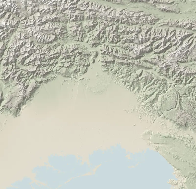
A town of 4,808 on the open plain south-west of Udine, 41 m above sea level. Its church bell tower, rises 113.2 m, was opened in 1959 and is described by the regional tourist board as the tallest in Italy. Its Friulian name is Mortean.
- Commuters to Udine: 18 min by car. There is no railway in town; the station used is Basiliano, a 13 min drive, with direct trains into Udine.
- Everyday needs: 2 supermarkets, 2 chemists, 2 primary schools and 1 lower secondary; for sixth-form age, pupils travel out.
- Winter light: nothing on the horizon blocks it. On 21 December the sun shines on the town hall for 8 h 38 min, 07:46 to 16:24.
- Getting away: Trieste airport 35 min, Venice airport 1 h 16; the sandy beach at Marina Julia 44 min; skiing at Tarvisio 1 h 15.
What homes cost, and how fast they sell
OMI (Osservatorio del Mercato Immobiliare, run by the Agenzia delle Entrate) splits the town into 3 zones; flats in average condition range from €650/m² to €1,200/m², unchanged over twelve months. Turnover is brisk: 3.1% of the housing stock sold in 2025, a rate beaten by only 7 municipalities of the 109 that OMI reports on.
| Mortegliano | Lestizza | Basiliano | Bicinicco | Pozzuolo del Friuli | Talmassons | Castions di Strada | |
|---|---|---|---|---|---|---|---|
| Standard homes (€/m²) | €905/m² | €885/m² | €885/m² | €885/m² | €900/m² | €870/m² | €860/m² |
| m² for €200,000 | 220 m² | 225 m² | 225 m² | 225 m² | 220 m² | 230 m² | 235 m² |
| 24h emergency room | 20 min | 22 min | 19 min | 13 min | 17 min | 23 min | 18 min |
| Fibre to the home | 90.5% | 97.6% | 82.8% | 98.3% | 49.9% | 31.7% | 23.6% |
| Buildings in flood areas | 63.9% | 66.6% | 21.0% | 1.0% | 24.0% | 66.1% | 58.1% |
Houses are roomy, 114 m² on average, and 84% of families own their home. Over half the buildings (56%) predate 1971. Second homes pay the regional property tax ILIA at 0.76%, the lowest standard rate any council in the region applies; one per owner, if registered with the council, pays 0.70% (how ILIA works). How a purchase works: our guide.
A&E and the specialist hospital, almost equally close
Palmanova hospital runs the closest emergency department, staffed around the clock and 20 min away by car. For the serious cases (cardiac, stroke, a bad road accident) crews drive to Udine's main hospital, only slightly further: 21 min. The regional helicopter base at Pasian di Prato lies 10 km north; the nearest hospital across a border is Šempeter pri Gorici in Slovenia, 42 min. Emergency number: 112 (drive times for every town).
Water, earthquakes, summer heat
- Flooding: in ISPRA's national hazard maps 63.9% of buildings fall in scenario P2, land that water could cover in a rare flood, expected once every 100–200 years; only 11 municipalities in the region have a higher share, Lestizza among them. P3, the frequent-flood scenario, covers 12% of the land. With a specific property, find out the floor level relative to the street and whether it has ever taken in water (floods and landslides). Landslides: none.
- Earthquakes: seismic zone 3, the lowest used in the region (it was zone 2 until 2010). The 1976 Friuli earthquake was felt here at 4-5 MCS, according to INGV (what to ask).
- Heat: summers are long, with 45 afternoons at 30 °C or above where the typical Friulian municipality has 37; 62 frosty nights and 1,210 mm of rain (climate, town by town).
Questions
What are house prices like in Mortegliano?
The OMI reference is €905/m² in a block of flats, €770/m² in a standalone house; €200,000 corresponds to roughly 220 m², before purchase taxes and the notary.
Where is the nearest hospital to Mortegliano?
The closest emergency department is Palmanova's, 20 min by road. Cardiac, stroke and major trauma cases go to Udine, 21 min.
Does Mortegliano flood?
Much of it lies in a flood-hazard zone: ISPRA puts 63.9% of buildings in the medium-hazard P2 scenario. The figure covers the whole town; for one house, check its plot and its history.
How tall is the Mortegliano bell tower?
113.2 m. Designed by the architect Pietro Zanini, it was inaugurated in 1959.
Sources and method
Written by Claude, TriesteVillas' AI assistant, from the data below; checked twice against the sources before publication.
The figures on this page come from:
- ISTAT SITUAS — comuni, caratteristiche del territorio, dimensione, aree di policy (data as of 2026-10-07) · CC BY 4.0
- PromoTurismoFVG (turismofvg.it) — «Campanile di Mortegliano»: 113,2 m, struttura in calcestruzzo armato a vista, pianta ottagonale, progetto di Pietro Zanini, inaugurato il 20 settembre 1959 (data as of 2026-10-23) · citato solo il fatto, nessun testo ripreso
- OSRM (router.project-osrm.org) su dati OpenStreetMap — tempi in auto senza traffico dalla sede municipale (data as of 2026-10-07) · dati © OpenStreetMap contributors, ODbL
- Tempi in auto senza traffico (OSRM su OpenStreetMap, estratto Geofabrik del 20/10/2026) dalla sede municipale alle spiagge, ai poli sciistici, a Pordenone e Gorizia, agli svincoli autostradali e alle stazioni con treni (orari Trenitalia/FUC verificati per un giorno feriale) (data as of 2026-10-22) · dati © OpenStreetMap contributors, ODbL
- OpenStreetMap (Overpass) per negozi, farmacie, ambulatori, poste e banche; Ministero dell'Istruzione per le scuole; Ministero della Salute per le farmacie (data as of 2026-10-22) · dati © OpenStreetMap contributors, ODbL; open data ministeriali IODL 2.0
- Ore di sole diretto calcolate da FriuliVillas sull'orizzonte del modello del terreno Copernicus GLO-30 (raggi fino a 60 km, curvatura e rifrazione) e sulla posizione del Sole (algoritmo NOAA), dalla sede municipale a 2 m dal suolo, cielo sereno. Produced using Copernicus WorldDEM-30 © DLR e.V. 2010-2014 and © Airbus Defence and Space GmbH 2014-2018 provided under COPERNICUS by the European Union and ESA; all rights reserved. Copernicus e l'ESA non sono responsabili di questo uso dei dati né lo approvano. (data as of 2026-10-22) · licenza Copernicus DEM GLO-30
- Agenzia delle Entrate — Osservatorio del Mercato Immobiliare (OMI): quotazioni per zona e tipologia; valore per comune = mediana dei punti medi delle zone OMI, stato normale (data as of 2026-10-22) · riuso con citazione della fonte (Agenzia delle Entrate – OMI)
- Agenzia delle Entrate — OMI, Statistiche regionali Friuli Venezia Giulia 2025: compravendite (NTN) e intensità del mercato (IMI) per comune (data as of 2026-10-22) · riuso con citazione della fonte (Agenzia delle Entrate – OMI)
- ISTAT — Censimento della popolazione e delle abitazioni 2011: abitazioni occupate e non occupate, epoca di costruzione degli edifici (data as of 2026-10-22) · CC BY 4.0
- Regione FVG — Portale ILIA (Imposta locale immobiliare autonoma, L.R. 17/2022): aliquote 2026 dalle delibere comunali (210 comuni dal Portale ILIA, 5 dal MEF) (data as of 2026-10-22) · atti ufficiali: le aliquote sono fatti ripubblicabili
- Tempi in auto senza traffico (OSRM su OpenStreetMap) dalla sede municipale ai pronto soccorso e agli ospedali hub; elenco delle strutture dalle aziende sanitarie ASUFC, ASUGI, ASFO e dalla L.R. 22/2019 (data as of 2026-10-22) · dati © OpenStreetMap contributors, ODbL; fatti dagli atti pubblici
- ISPRA IdroGEO — indicatori di rischio per comune (frane: mosaicatura PAI 2024; alluvioni: mosaicatura 2020) (data as of 2026-10-22) · CC BY 4.0
- Dipartimento della Protezione civile — classificazione sismica dei comuni (aggiornata al 31/05/2025) (data as of 2026-10-22) · CC BY 4.0
- INGV — Database Macrosismico Italiano DBMI15 v4.0 (Locati et al., 2022) (data as of 2026-10-22) · CC BY 4.0
- ARPA FVG – OSMER: normali climatiche 1991–2020 sulla griglia regionale a 500 m e sulle stazioni (temperature, pioggia, gelo, caldo, neve, vento) (data as of 2026-10-22) · ARPA FVG - OSMER e GRN, CC BY-SA 3.0 IT: i valori del clima ripubblicati qui restano sotto la stessa licenza
- AGCOM — Broadband Map, copertura delle reti fisse per comune (rilevazione al 05/10/2026); Infratel Italia — piano Banda ultra larga (data as of 2026-10-22) · CC BY 4.0; Infratel: riuso con citazione
- ISTAT — popolazione residente (censimenti 2001, 2011, permanente), indicatori demografici 2024, stranieri residenti (data as of 2026-10-22) · CC BY 4.0
- PromoTurismoFVG — Campanile di Mortegliano (2026-10-23)
- ERPAC, Regione FVG — heritage catalogue, record A_3849 (bell tower, architect Pietro Zanini) (2026-10-23)
- Regional law FVG 22/2019, art. 27: Palmanova as a base hospital (2026-10-22)
- Regione FVG — DGR 845 of 6 May 2010, seismic zoning (annex 1, 2003 zone) (2026-10-22)
- viaggiatreno.it (RFI) — departures from Basiliano station, weekday (2026-10-22)