
Living in Spilimbergo: a small town with a hospital, schools and falling prices
Spilimbergo is a town of 11,773 on the Tagliamento whose casualty unit is a 3 min drive from the municipal offices. Official values for flats fell more here over the last year than anywhere else in the region; the weak spots are broadband and the railway.
Published 23 October 2026
Driving times
- Udine
- 42 min
- Trieste
- 1 h 32
- Trieste Airport
- 1 h 08
- Klagenfurt
- 2 h 00
- The nearest sea
- 1 h 09
- The nearest slopes
- 1 h 02
- The motorway
- 32 min
- A station with trains
- 22 min
Health care
- 24h emergency room
- 3 min
- zone: 14 min
- Hub hospital
- 36 min
- zone: 28 min
Sunshine
- Direct sun on 21 December
- 8 h 38 min
- zone: 8 h 37 min
- Hours taken by the mountains
- -1 h -2 min
Prices (OMI)
- Standard homes
- €940/m²
- zone: €700/m²
- Detached houses
- €1,100/m²
- zone: €790/m²
- m² for €200,000
- 215 m²
- zone: 285 m²
- Rent
- €3.1/m² a month
Climate (1991–2020)
- January average
- 3.5 °C
- July highs
- 29.7 °C
- Rain per year
- 1,600 mm
- Frost days
- 71
Risks and broadband
- Seismic zone
- 2
- Buildings in flood area (P2)
- 5.4%
- Households with fibre
- 42.1%
- zone: 54.3%

Who lives here
- Residents
- 11,773
- Since 2001
- +6%
- Average age
- 47.8
- Empty homes (2011)
- 20%
Minutes of direct sun, day by day
direct sun with a flat horizon
Why people look at Spilimbergo
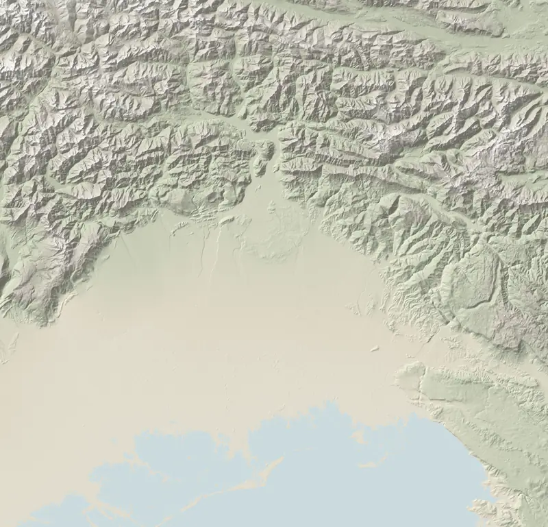
Spilimbergo sits on the right bank of the Tagliamento river, 131 m above sea level, between Pordenone and Udine. It is the largest municipality in its area of the upper plain; its population is up 6% on 2001.
Its name travels thanks to the Scuola Mosaicisti del Friuli, a mosaic school founded in 1922 that trains master mosaicists on a three-year course and keeps more than 800 works on show. Day to day, what matters is the rest: 8 supermarkets and 5 pharmacies mapped in the municipality, 3 upper secondary school sites.
- Good fit: anyone working in Pordenone or Udine, families with teenagers, buyers who put a hospital first.
- Poor fit: rail commuters, holiday-let investors (visitors spent only 27,200 nights here in 2025), home-workers until they have tested the connection at the address.
Airports: Venice 1 h 21, Trieste 1 h 08 (by car, no traffic).
A hospital in town
Regional law lists Spilimbergo among the smaller ‘base’ hospitals (ospedali di base); it belongs to ASFO, the western Friuli health authority, and its emergency department never closes. Where a cardiac arrest or stroke is suspected, crews make for a hub with cath lab and stroke unit: Pordenone (36 min) or Udine (40 min). The air ambulance flies from Pasian di Prato, 23 km as the crow flies.
Across Friuli Venezia Giulia only 6 municipalities have an A&E this close to the town hall. Emergencies in Italy: dial 112. The wider picture: hospitals and A&E.
Prices after a dip
The Revenue Agency's property observatory (OMI) splits Spilimbergo into 3 zones, with flats between €600/m² and €1,150/m²; the town-wide figure is €940/m², detached and semi-detached houses €1,100/m². In round numbers, €200,000 buys about 215 m² of flat, before taxes and notary (what a budget buys).
The figure to watch: between the first halves of 2025 and 2026 the town-wide value (the median of its zones) moved by -6.0%, the sharpest cut anywhere in the region, where most values did not move at all. Against 2021 it is still up 18.2%, but that rise comes from one zone, around Via Cavour and Via Corridoni; the historic centre is roughly where it was. Sales of homes in 2025 numbered 138, a change of -7.0% year on year. OMI rent: €3.1/m² a month; paper yield before costs 4.0%.
How buying works for foreigners: buying a house in Italy.
Broadband, trains, earthquakes
| Spilimbergo | Maniago | San Daniele del Friuli | San Giorgio della Richinvelda | Sequals | |
|---|---|---|---|---|---|
| Standard homes (€/m²) | €940/m² | €875/m² | €950/m² | €700/m² | €650/m² |
| 24h emergency room | 3 min | 19 min | 3 min | 10 min | 9 min |
| Fibre to the home | 42.1% | 97.8% | 2.2% | 87.2% | 11.1% |
| From Udine | 42 min | 59 min | 35 min | 44 min | 49 min |
| Sun on 21 December | 8 h 38 min | 8 h 22 min | 8 h 32 min | 8 h 37 min | 5 h 33 min |
- Broadband: fibre runs into the home for 42.1% of households; elsewhere it stops at the street cabinet and copper does the rest. Check the exact address (fibre by town).
- Getting about: no passenger trains stop in town; the nearest served station is Maniago, 22 min by car, but its trains only run to Sacile; for direct trains to Udine, Venice and Trieste, Casarsa is 23 min away. The motorway junction (Pordenone Dogana) is 32 min away.
- Earthquakes: seismic zone 2; in May 1976 shaking here reached 8 on the MCS scale, and 61% of residential buildings predate 1971. Ask for the structural paperwork (what to ask).
- The river: 32% of the land is in the high flood-hazard class, yet only 5.4% of buildings lie in medium-hazard areas.
- Sun: unobstructed at the town hall, but 250 m away it drops to 7 h 53 min in places: worth computing for a specific house.
Questions
Is there an A&E department in Spilimbergo?
There is, round the clock, a 3 min drive from the centre. For cardiac and stroke emergencies ambulances go on to Pordenone (36 min) or Udine (40 min).
How much are houses in Spilimbergo?
OMI values flats at €940/m² and houses at €1,100/m². The 2026 change for flats was -6.0%, after rises between 2021 and 2025.
Can you get to Spilimbergo by train?
Not directly: no passenger services stop there. The closest station with trains is Maniago, 22 min by car, but it only has trains to Sacile; direct trains to Udine and Venice leave from Casarsa, 23 min away.
How far is Spilimbergo from the sea and the mountains?
The nearest beach, Lignano Pineta, is 1 h 09 away; the Piancavallo ski slopes 1 h 02.
Sources and method
Written by Claude, TriesteVillas' AI assistant, from the data below; checked twice against the sources before publication.
The figures on this page come from:
- ISTAT SITUAS — comuni, caratteristiche del territorio, dimensione, aree di policy (data as of 2026-10-07) · CC BY 4.0
- ISTAT — popolazione residente (censimenti 2001, 2011, permanente), indicatori demografici 2024, stranieri residenti (data as of 2026-10-22) · CC BY 4.0
- OpenStreetMap (Overpass) per negozi, farmacie, ambulatori, poste e banche; Ministero dell'Istruzione per le scuole; Ministero della Salute per le farmacie (data as of 2026-10-22) · dati © OpenStreetMap contributors, ODbL; open data ministeriali IODL 2.0
- Regione FVG — Servizio statistica, movimento turistico per comune (arrivi e presenze 2023–2025, mensile) (data as of 2026-10-22) · dati regionali, riuso con citazione (v. note/turismo.md)
- OSRM (router.project-osrm.org) su dati OpenStreetMap — tempi in auto senza traffico dalla sede municipale (data as of 2026-10-07) · dati © OpenStreetMap contributors, ODbL
- Tempi in auto senza traffico (OSRM su OpenStreetMap) dalla sede municipale ai pronto soccorso e agli ospedali hub; elenco delle strutture dalle aziende sanitarie ASUFC, ASUGI, ASFO e dalla L.R. 22/2019 (data as of 2026-10-22) · dati © OpenStreetMap contributors, ODbL; fatti dagli atti pubblici
- Agenzia delle Entrate — Osservatorio del Mercato Immobiliare (OMI): quotazioni per zona e tipologia; valore per comune = mediana dei punti medi delle zone OMI, stato normale (data as of 2026-10-22) · riuso con citazione della fonte (Agenzia delle Entrate – OMI)
- Agenzia delle Entrate — OMI, Statistiche regionali Friuli Venezia Giulia 2025: compravendite (NTN) e intensità del mercato (IMI) per comune (data as of 2026-10-22) · riuso con citazione della fonte (Agenzia delle Entrate – OMI)
- AGCOM — Broadband Map, copertura delle reti fisse per comune (rilevazione al 05/10/2026); Infratel Italia — piano Banda ultra larga (data as of 2026-10-22) · CC BY 4.0; Infratel: riuso con citazione
- Tempi in auto senza traffico (OSRM su OpenStreetMap, estratto Geofabrik del 20/10/2026) dalla sede municipale alle spiagge, ai poli sciistici, a Pordenone e Gorizia, agli svincoli autostradali e alle stazioni con treni (orari Trenitalia/FUC verificati per un giorno feriale) (data as of 2026-10-22) · dati © OpenStreetMap contributors, ODbL
- Dipartimento della Protezione civile — classificazione sismica dei comuni (aggiornata al 31/05/2025) (data as of 2026-10-22) · CC BY 4.0
- INGV — Database Macrosismico Italiano DBMI15 v4.0 (Locati et al., 2022) (data as of 2026-10-22) · CC BY 4.0
- ISTAT — Censimento della popolazione e delle abitazioni 2011: abitazioni occupate e non occupate, epoca di costruzione degli edifici (data as of 2026-10-22) · CC BY 4.0
- ISPRA IdroGEO — indicatori di rischio per comune (frane: mosaicatura PAI 2024; alluvioni: mosaicatura 2020) (data as of 2026-10-22) · CC BY 4.0
- Ore di sole diretto calcolate da FriuliVillas sull'orizzonte del modello del terreno Copernicus GLO-30 (raggi fino a 60 km, curvatura e rifrazione) e sulla posizione del Sole (algoritmo NOAA), dalla sede municipale a 2 m dal suolo, cielo sereno. Produced using Copernicus WorldDEM-30 © DLR e.V. 2010-2014 and © Airbus Defence and Space GmbH 2014-2018 provided under COPERNICUS by the European Union and ESA; all rights reserved. Copernicus e l'ESA non sono responsabili di questo uso dei dati né lo approvano. (data as of 2026-10-22) · licenza Copernicus DEM GLO-30
- ARPA FVG – OSMER: normali climatiche 1991–2020 sulla griglia regionale a 500 m e sulle stazioni (temperature, pioggia, gelo, caldo, neve, vento) (data as of 2026-10-22) · ARPA FVG - OSMER e GRN, CC BY-SA 3.0 IT: i valori del clima ripubblicati qui restano sotto la stessa licenza
- Scuola Mosaicisti del Friuli — the school, three-year professional course, works on display (Spilimbergo) (2026-10-23)
- Friuli Venezia Giulia Regional Law 22/2019, art. 27 — ‘base’ hospitals (2026-10-22)
- ASFO — emergency departments: Pordenone, San Vito al Tagliamento, Spilimbergo (2026-10-22)
- viaggiatreno.it (RFI) — departures on 23/10/2026 from stations on the Sacile–Maniago line (2026-10-23)