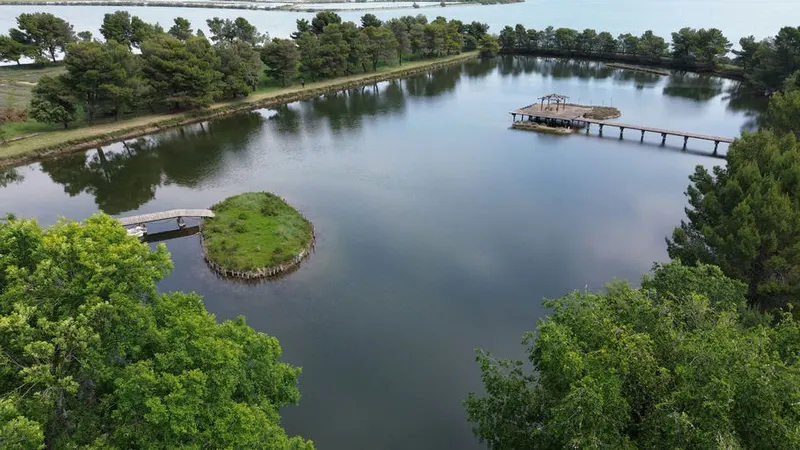
Grado: a home between lagoon and sea, pros and cons in figures
Foreign guests account for 80% of tourist nights in Grado, and no town in the region sees more foreigners staying in homes of their own. It suits a seaside second home 2 h 26 from Klagenfurt; for year-round living, weigh the water, the town's age profile and an A&E 38 min away.
Published 22 October 2026
Driving times
- Udine
- 57 min
- Trieste
- 1 h 02
- Trieste Airport
- 34 min
- Klagenfurt
- 2 h 26
- The nearest sea
- 5 min
- The nearest slopes
- 1 h 44
- The motorway
- 32 min
- A station with trains
- 27 min
Health care
- 24h emergency room
- 38 min
- zone: 25 min
- Hub hospital
- 56 min
- zone: 42 min
Sunshine
- Direct sun on 21 December
- 8 h 37 min
- zone: 8 h 36 min
- Hours taken by the mountains
- 2 min
Prices (OMI)
- Standard homes
- €2,200/m²
- zone: €910/m²
- Detached houses
- €1,560/m²
- zone: €795/m²
- m² for €200,000
- 90 m²
- zone: 220 m²
- Rent
- €6.9/m² a month
Climate (1991–2020)
- January average
- 6.0 °C
- July highs
- 28.6 °C
- Rain per year
- 970 mm
- Frost days
- 15
Risks and broadband
- Seismic zone
- 3
- Buildings in flood area (P2)
- 53.2%
- Households with fibre
- 21.5%
- zone: 87.8%

Who lives here
- Residents
- 7,532
- Since 2001
- -15%
- Average age
- 53.3
- Empty homes (2011)
- 67%
Minutes of direct sun, day by day
direct sun with a flat horizon
A second home for many Austrians
In 2025 Grado logged 1,499,900 tourist nights, 199.1 per resident: 80% by foreign guests, 66% in June to August and only 3% in December to March. The Bank of Italy's international tourism survey (2021–2025) goes further: of all the nights foreigners spend in a home they own in Friuli Venezia Giulia, 20.5% are in Grado — more than in any other town — and 77% of those belong to Austrian residents. Trieste Airport is 34 min away; at weekends, Villach-bound Mi.Co.Tra. services call at Cervignano-Aquileia-Grado, 27 min by car.
Year-round residents are older than elsewhere: a mean age of 53.3, above the regional median (49.7), with 34% aged over 65. And numbers are falling: -15% since 2001.
Water and climate: the limits to know
The municipal area sits at an average of 0 m above sea level. ISPRA places 53.2% of buildings in P2 zones, where the flood hazard is rated medium: the scenario Italian flood law (Legislative Decree 49/2010) ties to a return period of 100–200 years. The figure rests on the 2011 census and may not cover storm surges: for a specific house, its own elevation and the detailed maps count, not the town average. More: floods and landslides.
January averages 6.0 °C, with 15 frost days and 56 tropical nights a year. But here the climate data are unreliable: ARPA's grid does not cover the seafront centre, so the value comes from the nearest cell that has one. Treat it as an order of magnitude.
Hospitals: Monfalcone, Udine and, in summer, in town
The nearest A&E open all year, day and night, is in Monfalcone: 38 min by car, not counting summer traffic. The hub hospital is in Udine, 56 min away. In town, a first-aid point opens only in summer. If you plan to retire here, weigh those minutes as much as the sea view. More: hospitals and A&E.
Buying in Grado, and how it compares with Lignano
The OMI median for standard homes is €2,200/m²; only 2 towns cost more across the region. It is a median across zones: the central ones reach €3,275/m², and across the town's 7 zones values run from €850/m² to €3,800/m². Last year's sales: 326 homes.
Like the whole former province of Gorizia, Grado uses the land register: you own the property once the land-register entry is made, not when you sign. The regional ILIA on a second home is 0.95%, or 0.70% once notified online as the owner's designated «first second home» (by June of the following year; one per owner in the whole region).
| Grado | Lignano Sabbiadoro | |
|---|---|---|
| Standard homes (€/m²) | €2,200/m² | €3,040/m² |
| m² for €200,000 | 90 m² | 65 m² |
| Tourist nights (2025) | 1,499,900 | 3,702,600 |
| Foreign tourists | 80% | 66% |
| 24h emergency room | 38 min | 24 min |
| Buildings in flood areas | 53.2% | 8.8% |
| From Klagenfurt | 2 h 26 | 2 h 32 |
The other beach town's profile: Lignano Sabbiadoro.
Questions
Grado or Lignano: which is better for a seaside home?
It depends on what matters most. Lignano is pricier (€3,040/m² against €2,200/m²) and closer to an A&E (24 min against 38 min); Grado has a higher share of foreign guests and many more buildings in flood-hazard areas (53.2% against 8.8%).
Does Grado have an A&E department?
Only a summer first-aid point. The A&E open all year round is in Monfalcone, 38 min without traffic; serious cases go to Udine (56 min).
How much is a flat in Grado?
OMI's first-half-2026 median for standard homes is €2,200/m², rising to €3,275/m² in the central zones. Ordinary homes only.
Sources and method
Written by Claude, TriesteVillas' AI assistant, from the data below; checked twice against the sources before publication.
The figures on this page come from:
- Regione FVG — Servizio statistica, movimento turistico per comune (arrivi e presenze 2023–2025, mensile) (data as of 2026-10-22) · dati regionali, riuso con citazione (v. note/turismo.md)
- Elaborazioni FriuliVillas su dati Banca d'Italia, Indagine sul turismo internazionale dell'Italia, microdati 2021–2025 (tabelle pivot, file del 20/03/2026) (data as of 2026-10-22) · riuso con la citazione chiesta dalla Banca d'Italia
- OSRM (router.project-osrm.org) su dati OpenStreetMap — tempi in auto senza traffico dalla sede municipale (data as of 2026-10-07) · dati © OpenStreetMap contributors, ODbL
- Tempi in auto senza traffico (OSRM su OpenStreetMap, estratto Geofabrik del 20/10/2026) dalla sede municipale alle spiagge, ai poli sciistici, a Pordenone e Gorizia, agli svincoli autostradali e alle stazioni con treni (orari Trenitalia/FUC verificati per un giorno feriale) (data as of 2026-10-22) · dati © OpenStreetMap contributors, ODbL
- ISTAT — popolazione residente (censimenti 2001, 2011, permanente), indicatori demografici 2024, stranieri residenti (data as of 2026-10-22) · CC BY 4.0
- ISTAT — Altimetria dei comuni dal modello digitale del terreno (31/12/2021) (data as of 2026-10-07) · CC BY 4.0
- ISPRA IdroGEO — indicatori di rischio per comune (frane: mosaicatura PAI 2024; alluvioni: mosaicatura 2020) (data as of 2026-10-22) · CC BY 4.0
- ARPA FVG – OSMER: normali climatiche 1991–2020 sulla griglia regionale a 500 m e sulle stazioni (temperature, pioggia, gelo, caldo, neve, vento) (data as of 2026-10-22) · ARPA FVG - OSMER e GRN, CC BY-SA 3.0 IT: i valori del clima ripubblicati qui restano sotto la stessa licenza
- Tempi in auto senza traffico (OSRM su OpenStreetMap) dalla sede municipale ai pronto soccorso e agli ospedali hub; elenco delle strutture dalle aziende sanitarie ASUFC, ASUGI, ASFO e dalla L.R. 22/2019 (data as of 2026-10-22) · dati © OpenStreetMap contributors, ODbL; fatti dagli atti pubblici
- Agenzia delle Entrate — Osservatorio del Mercato Immobiliare (OMI): quotazioni per zona e tipologia; valore per comune = mediana dei punti medi delle zone OMI, stato normale (data as of 2026-10-22) · riuso con citazione della fonte (Agenzia delle Entrate – OMI)
- Agenzia delle Entrate — OMI, Statistiche regionali Friuli Venezia Giulia 2025: compravendite (NTN) e intensità del mercato (IMI) per comune (data as of 2026-10-22) · riuso con citazione della fonte (Agenzia delle Entrate – OMI)
- Comune di Grado, delibera n. 7 del 07/01/2026: aliquote ILIA 2026 (Portale ILIA della Regione FVG) (data as of 2026-10-22) · atto ufficiale (art. 5 L. 633/1941); le aliquote sono fatti
- Ore di sole diretto calcolate da FriuliVillas sull'orizzonte del modello del terreno Copernicus GLO-30 (raggi fino a 60 km, curvatura e rifrazione) e sulla posizione del Sole (algoritmo NOAA), dalla sede municipale a 2 m dal suolo, cielo sereno. Produced using Copernicus WorldDEM-30 © DLR e.V. 2010-2014 and © Airbus Defence and Space GmbH 2014-2018 provided under COPERNICUS by the European Union and ESA; all rights reserved. Copernicus e l'ESA non sono responsabili di questo uso dei dati né lo approvano. (data as of 2026-10-22) · licenza Copernicus DEM GLO-30
- Dipartimento della Protezione civile — classificazione sismica dei comuni (aggiornata al 31/05/2025) (data as of 2026-10-22) · CC BY 4.0
- AGCOM — Broadband Map, copertura delle reti fisse per comune (rilevazione al 05/10/2026); Infratel Italia — piano Banda ultra larga (data as of 2026-10-22) · CC BY 4.0; Infratel: riuso con citazione
- ISTAT SITUAS — comuni, caratteristiche del territorio, dimensione, aree di policy (data as of 2026-10-07) · CC BY 4.0
- ISTAT — Censimento della popolazione e delle abitazioni 2011: abitazioni occupate e non occupate, epoca di costruzione degli edifici (data as of 2026-10-22) · CC BY 4.0
- Court of Trieste: areas where the land-register system applies (PDF, April 2026) — the whole province of Gorizia (2026-10-22)
- Friuli Venezia Giulia Region, «Pronto soccorso» service: Grado seasonal first-aid point (read 22/10/2026) (2026-10-22)
- FUC – Ferrovie Udine Cividale, Mi.Co.Tra. Udine–Villach–Trieste timetable (14/12/2025–12/12/2026) (2026-10-22)
- Regional Law FVG 17/2022 (ILIA), art. 9: rates (2026-10-22)
- Regional Law FVG 17/2022, art. 13 bis: notifying the first «second home» (2026-10-22)
Homes for sale nearby
All homes →Grado and Aquileia